HISTORIX Vintage 1876 Salem Oregon Map and 50 similar items


Free Shipping
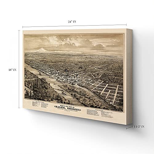
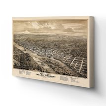
HISTORIX Vintage 1876 Salem Oregon Map Canvas - 18x24x1.5 Inch Canvas Wrap Vinta
£190.29 GBP - £210.51 GBP
View full item details »

Shipping options
Seller handling time is 1 business day Details
No shipping price specified to GB
Ships from
United States

Return policy
Full refund available for DOAs
Details
Purchase protection
Payment options
PayPal accepted
PayPal Credit accepted
Venmo accepted
PayPal, MasterCard, Visa, Discover, and American Express accepted
Maestro accepted
Amazon Pay accepted
Nuvei accepted
View full item details »
Shipping options
Seller handling time is 1 business day Details
No shipping price specified to GB
Ships from
United States
Return policy
Full refund available for DOAs
Details
Purchase protection
Payment options
PayPal accepted
PayPal Credit accepted
Venmo accepted
PayPal, MasterCard, Visa, Discover, and American Express accepted
Maestro accepted
Amazon Pay accepted
Nuvei accepted
Item traits
| Category: | |
|---|---|
| Quantity Available: |
16 in stock |
| Condition: |
New |
| ASIN: |
B095M7YD9R |
| Item Name: |
1876 Bird's eye view of Salem, Oregon |
| Item Type Keyword: |
artwork |
| Unspsc Code: |
60121013 |
| sizes: |
Listing details
| Seller policies: | |
|---|---|
| Shipping discount: |
Seller pays shipping for this item. |
| Posted for sale: |
May 1 |
| Item number: |
1743606914 |
Item description
Capital city Salem, Oregon, has a rich history and is depicted here by one of the most prolific city illustrators of the era Eli Glover. Illustrated using an eastern facing perspective with Mt Hood as a backdrop, the Capitol State Building proudly depicted as a focal point. Geographically Salem is the center of the Willamette Valley and became the capital of the Oregon territory in 1851.
This map produced in 1876 is of particular historical importance as the year marked the completion of the second state capital, which was rebuilt on the site of the previous State House. The second capitol was built with revival-style architecture and found inspiration in the nation’s capitol building.
Illustrated to highlight important regional buildings and manufacturing interests, perspective maps were not drawn to scale and typically showed the area from an oblique angle. These unique maps were intended to give the viewer a sense of place, now they provide a link to the past and instill a connection to the region’s history. Prominent businesses would display these maps with pride as they were often notated in the legend.
Outside of the city, one sees the importance of agriculture for the area with the depiction of the numerous fields and farmhouses dotting the landscape. Agriculture has always been an essential part of Salem’s domestic economy, and it’s vast production of cherries led to its nickname “Cherry City.” Salem is also bisected by the 45th parallel, the halfway point between the North Pole and the equator.
Our ready-to-hang canvas wall art prints are made in the USA using the highest quality materials with professional craftsmanship. This beautiful artwork is a perfect addition to your themed decor. Historic prints look great in the home, study or office. They also make an unforgettable gift.
|
Why are we showing these items?
Booth
Historic Prints |

|


-
Refine your browsing experience
We can show you more items that are exactly like the original item, or we can show you items that are similar in spirit. By default we show you a mix.


This item has been added to your cart
 HISTORIX Vintage 1876 Salem Oregon Map Canvas - 18x24x1.5 Inch Canvas Wrap Vinta added to cart.
16 available in stock
HISTORIX Vintage 1876 Salem Oregon Map Canvas - 18x24x1.5 Inch Canvas Wrap Vinta added to cart.
16 available in stock
View Cart or continue shopping.
 Please wait while we finish adding this item to your cart.
Get an item reminder
We'll email you a link to your item now and follow up with a single reminder (if you'd like one). That's it! No spam, no hassle.
Already have an account?
Log in and add this item to your wish list.