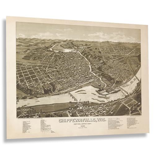
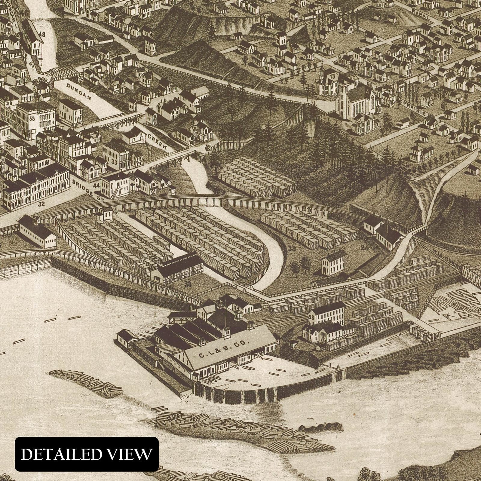
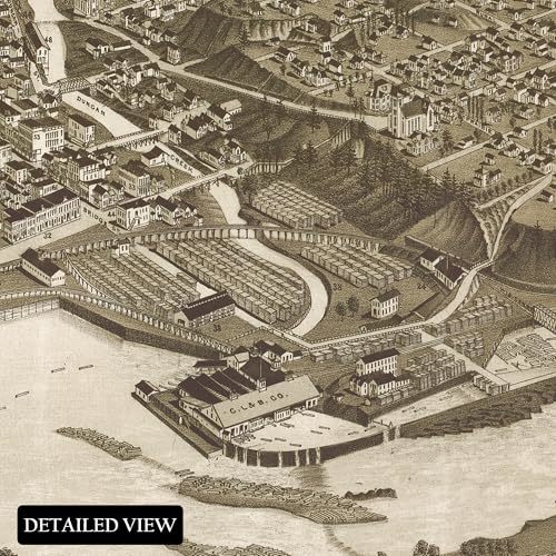
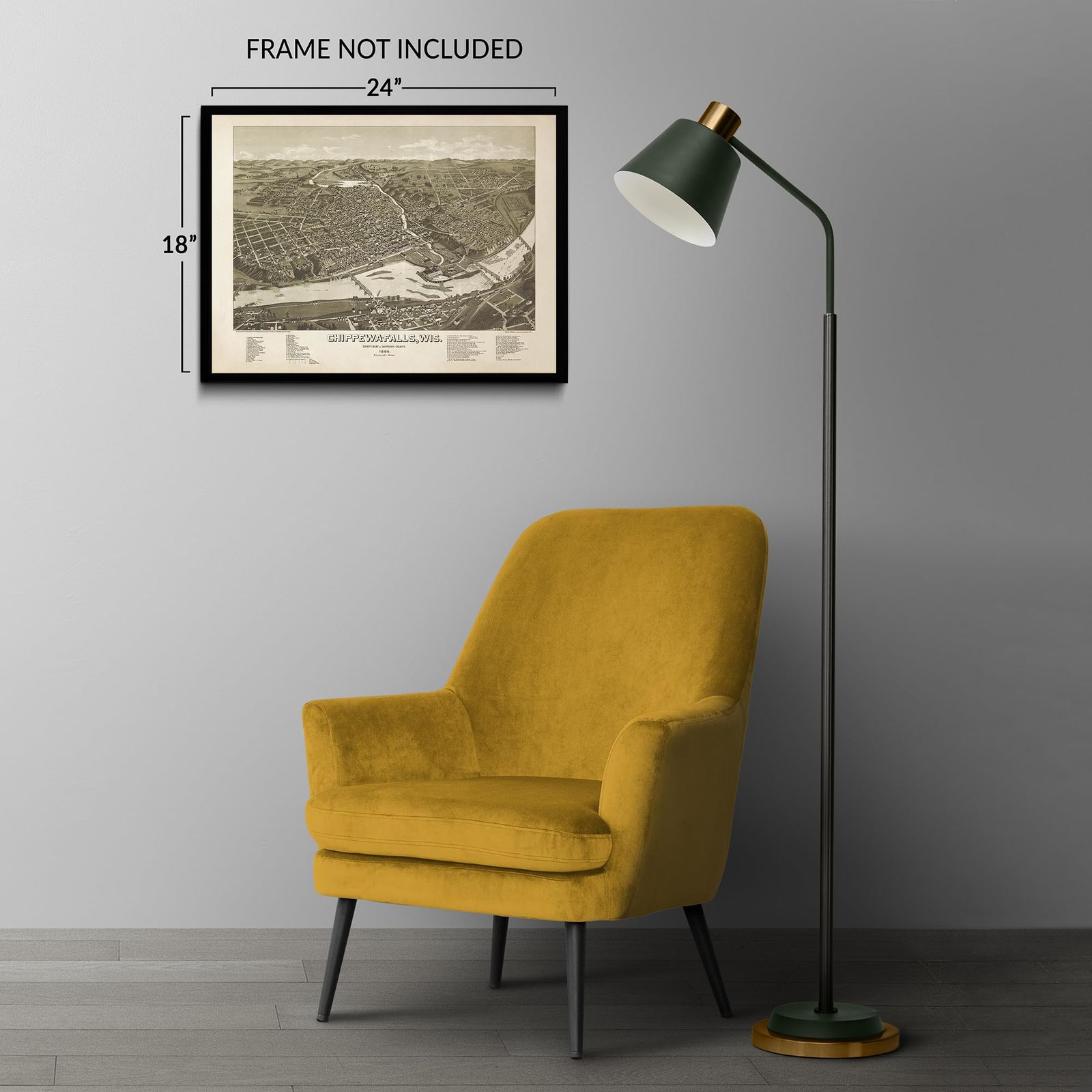
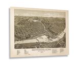
Located along the banks of the Chippewa River, Chippewa Falls, Wisconsin, is depicted here in one of the most popular cartographic styles of the 19th century. This bird’s-eye perspective captures the city during a period of significant growth and transformation, as the Industrial Revolution fueled prosperity and advancements in transportation infrastructure. Following the American Civil War (1865), the expansion of rail lines provided greater access to cities across the region, accelerating economic development. Chippewa Falls was officially incorporated in 1869, though European settlers had established fur trading outposts and blacksmithing industries as early as 1838.
By the time this panoramic map was produced, Chippewa Falls had experienced considerable growth, becoming an integral part of the Eau Claire metropolitan region and serving as the county seat since 1854. Bird’s-eye perspective maps, widely produced in the 19th century, were created to market towns and cities, highlighting notable civic landmarks, such as churches, schools, and government buildings, while also promoting economic opportunities to attract new residents. These maps are distinguished by their unique aesthetic and distinctive artistic style, offering a historical snapshot that connects viewers to the past and present.
This illustration of Chippewa Falls was created by Henry Wells, one of the most prolific and respected panoramic mapmakers of his time. Wells was responsible for producing more than half of all bird’s-eye perspective maps in the Library of Congress’s collection, solidifying his legacy as a leading figure in American cartography.
Additional Details
------------------------------
Bullet point: VINTAGE MAP REPRODUCTION: You?ll love this high quality historic reproduction of 1886 Chippewa Falls Wisconsin Map Print. Our museum quality prints are archival grade, which means it will look great and last without fading for over 100 years. Our print to order maps are made in the USA and each map is inspected for quality. This beautiful artwork is a perfect addition to your themed decor. Vintage maps look great in the home, study or office. They make a perfect gift as well.
Product description:
Located along the banks of the Chippewa River, Chippewa Falls, Wisconsin, is depicted here in one of the most popular cartographic styles of the 19th century. This bird’s-eye perspective captures the city during a period of significant growth and transformation, as the Industrial Revolution fueled prosperity and advancements in transportation infrastructure. Following the American Civil War (1865), the expansion of rail lines provided greater access to cities across the region, accelerating economic development. Chippewa Falls was officially incorporated in 1869, though European settlers had established fur trading outposts and blacksmithing industries as early as 1838.
By the time this panoramic map was produced, Chippewa Falls had experienced considerable growth, becoming an integral part of the Eau Claire metropolitan region and serving as the county seat since 1854. Bird’s-eye perspective maps, widely produced in the 19th century, were created to market towns and cities, highlighting notable civic landmarks, such as churches, schools, and government buildings, while also promoting economic opportunities to attract new residents. These maps are distinguished by their unique aesthetic and distinctive artistic style, offering a historical snapshot that connects viewers to the past and present.
This illustration of Chippewa Falls was created by Henry Wells, one of the most prolific and respected panoramic mapmakers of his time. Wells was responsible for producing more than half of all bird’s-eye perspective maps in the Library of Congress’s collection, solidifying his legacy as a leading figure in American cartography.