HISTORIX Vintage 1886 State of Michigan Map - 18x24 Inch Vintage Map of Michigan
Ships from
United States

Shipping options
Seller handling time is 1 business day Details
This reflects the seller's handling time and may not include time spent in transit.
If you have questions about shipping, please contact the seller.
No shipping price specified to GB
Ships from
United States
Return policy
Full refund available for DOAs
Details
- We guarantee our products and offer full refunds or exchange for defective items or items not as-described.
- Buyer must contact us within 30 days after receipt of shipment.
- The item must be received in the same condition as shipped.
- Items must be returned with all original packaging and accessories.
- Items must not be abused, modified or damaged by accident.
- A 20% restocking fee will be charged for returns
- Buyer is responsible for all return shipping and handling fees.
- Restocking and return shipping fees do not apply when item is returned as defective or because incorrect product was delivered.
Payment options
PayPal accepted
PayPal Credit accepted
Venmo accepted
PayPal, MasterCard, Visa, Discover, and American Express accepted
Maestro accepted
Amazon Pay accepted
Nuvei accepted
Item traits
| Category: |
Kitchen Scales
|
| Quantity Available: |
16 in stock
|
| Condition: |
New
|
| ASIN: |
B086GTXJMF
|
| Item Name: |
HISTORIX 1886 Map of Michigan
|
| manufacturer: |
Historix
|
| Item Type Keyword: |
prints
|
| Product Site Launch Date: |
2020-03-27T03:39:57.022Z
|
| Brand: |
HISTORIX
|
| Unspsc Code: |
52140000
|
| sizes: |
View details
18x24 Inch (8 in stock)
24x32 Inch (8 in stock)
|
Listing details
|
Seller policies:
|
View seller policies
|
|
Shipping discount:
|
Seller pays shipping for this item.
|
|
Posted for sale:
|
April 29
|
|
Item number:
|
1743200301
|
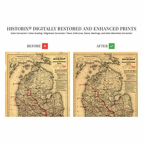
This unique piece of Railway history was published in 1886, which marked the end of the third major Railway expansion in Michigan. This wave of construction was spurred on by the passing of legislation gifting the Railroad companies 5 million acres of land, which they could sell to build lines connecting major cities and towns. This allowed trade to boom across the state, allowing easy access to the states upper peninsula.
The map details the connections at Toledo, Ann Arbor, and North Michigan, illustrating the connections and providing viewers a glimpse into the era. These hubs supported a thriving iron ore and copper industry form the western part of the state. Published before the final push of Railroad construction in the late 1880s, which saw the network grow from 1000 miles to over 9000 miles by 1890. This last period has been referred to by historians as Michigans Railroad mania.
Ann Arbor saw a surge in population in the mid-1880s sparked by an expanding milling industry the region experienced a massive influx of immigrants from eastern Europe as well as Italy, and Greece. The city is also home to the University of Michigan, which relocated from Detroit in 1837.
These maps were a valuable resource to residents and merchants alike and even included information regarding drainage. The maps also include detailed descriptions of Railroad traffic, which gives the viewer another level of context for what life was like at this time; this is an authentic piece of cartographical and Railroad history.
Our museum quality giclee print comes printed with archival ink on premium heavyweight matte paper. Shipped in a sturdy cardboard tube your print will arrive ready to be framed. This eye-catching print makes the perfect gift for anyone that loves history and imagery.